
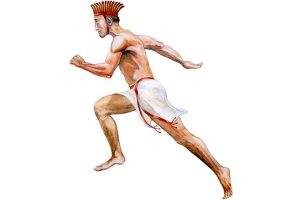
How the Crusaders Were Defeated in Anatolia: New Evidence Reveals the Route and Fortress of the Battle of Merzifon
For centuries, the defeat of the Crusader armies in Anatolia in 1101 has been known largely through fragmented medieval chronicles. Now, new archaeological and historical research in northern Anatolia is transforming that narrative. Scholars working in the Amasya–Merzifon region say they have identified the precise route taken by the Crusaders—and the strategic fortress where their advance collapsed—offering fresh insight into how Sultan Kilij Arslan I engineered one of the most decisive defeats of the early Crusades.
The findings emerge from an ongoing, state-authorized research project examining the routes and battle landscapes of the Crusades of 1101—an episode that played a critical role in securing Anatolia as a permanent Turkish homeland in the aftermath of the Battle of Manzikert.
Tracing the Crusaders’ Path Across Northern Anatolia
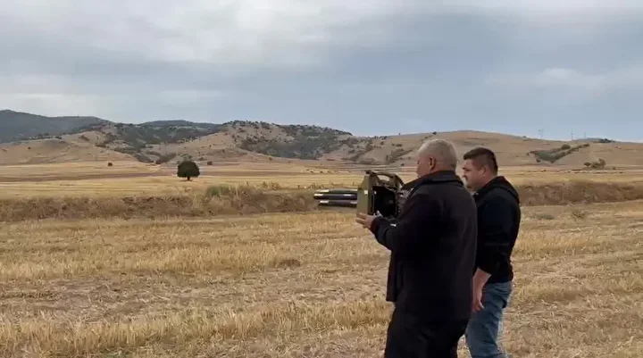
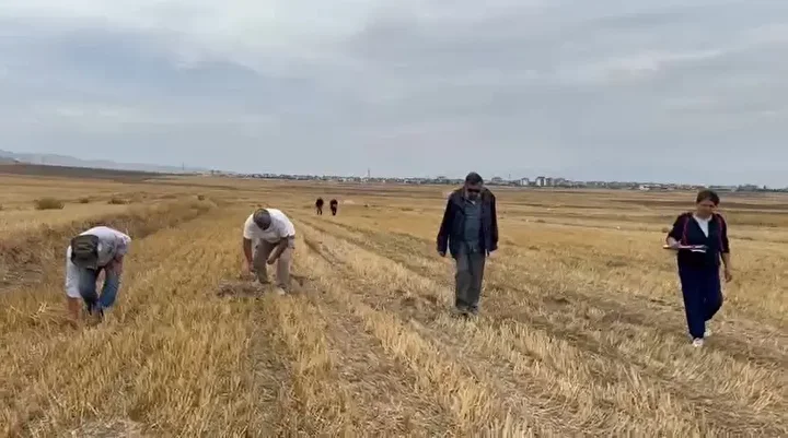
The interdisciplinary survey, conducted with permission from Türkiye’s Ministry of Culture and Tourism and involving researchers from multiple universities, has focused over the past two years on the provinces of Amasya and Konya. Fieldwork has concentrated in the districts of Merzifon and Gümüşhacıköy, areas long mentioned in medieval sources but never precisely mapped on the ground.
According to Dr. Neslihan Korkmaz of Amasya University, who serves as a scientific advisor to the project, researchers were able this year to reconstruct the Crusaders’ route with a high degree of confidence. The army appears to have followed what was historically known as the “Pilgrims’ Road” or “Jerusalem Road,” passing through Tosya, Osmancık, Gümüşhacıköy, and finally Merzifon.
📣 Our WhatsApp channel is now LIVE! Stay up-to-date with the latest news and updates, just click here to follow us on WhatsApp and never miss a thing!!
This route, once a major corridor for both religious pilgrimage and military movement, aligns closely with descriptions found in contemporary Latin and Byzantine chronicles. The identification bridges a long-standing gap between textual sources and physical geography.
The Fortress Where the Crusaders Fell into Ambush
Perhaps the most striking outcome of the research is the identification of a fortress located only a few miles from the main Crusader camp. Archaeological and topographical analysis suggests that this stronghold was used as a logistical point where Crusader detachments sought provisions—an action that ultimately proved fatal.
Dr. Korkmaz explains that the fortress appears to have been the site of a carefully planned Seljuk ambush. Rather than a single pitched battle, the defeat at Merzifon was part of a broader strategy in which Sultan Kilij Arslan I engaged the Crusader forces repeatedly over the course of roughly a month, exhausting and fragmenting them before delivering decisive blows.
This tactical approach culminated in the crushing defeat of the Crusader army near Merzifon, marking one of the most significant failures of Western forces during the early Crusades.
A Turning Point After Manzikert
While the Battle of Manzikert in 1071 famously opened Anatolia to Turkish settlement, historians increasingly emphasize the importance of the 1101 campaigns in consolidating that transformation. The destruction of multiple Crusader armies under Kilij Arslan I demonstrated that Seljuk control of Anatolia was not temporary but durable.
The Battle of Merzifon, in particular, stands out as a moment when Seljuk military strategy, intimate knowledge of terrain, and mobility overcame heavily armed but overstretched Crusader forces. The new findings provide concrete geographical anchors for understanding how this victory unfolded on the ground.
Looking Ahead: Graves, Weapons, and DNA Research
The project is far from complete. Future phases aim to locate burial sites associated with both Crusader soldiers and Seljuk warriors who fell during the fighting. Archaeologists also hope to recover weapons and military equipment that could offer further insight into the nature of the clashes.
Amasya University Rector Prof. Dr. Ahmet Hakkı Turabi has indicated that, if graves are identified, DNA samples may be collected to support interdisciplinary research combining archaeology, history, and bioarchaeology. Such analyses could provide rare information about the origins and composition of the opposing armies.
Together, these efforts promise to transform the Battle of Merzifon from a largely text-based historical episode into a well-documented archaeological landscape—one that speaks directly to the formative centuries of medieval Anatolia.
- A 1700-year-old statue of Pan unearthed during the excavations at Polyeuktos in İstanbul
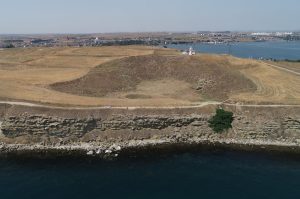
- The granary was found in the ancient city of Sebaste, founded by the first Roman emperor Augustus
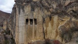
- Donalar Kale Kapı Rock Tomb or Donalar Rock Tomb
- Theater emerges as works continue in ancient city of Perinthos
- Urartian King Argishti’s bronze shield revealed the name of an unknown country
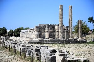
- The religious center of Lycia, the ancient city of Letoon
- Who were the Luwians?
- A new study brings a fresh perspective on the Anatolian origin of the Indo-European languages

- Perhaps the oldest thermal treatment center in the world, which has been in continuous use for 2000 years -Basilica Therma Roman Bath or King’s Daughter-
- The largest synagogue of the ancient world, located in the ancient city of Sardis, is being restored
Leave a Reply